Landboxes
Developments

Currently Landboxes has two digital developments designed during the previous season for New York and San Francisco (USA), and now is involved in other two, more detailed, for Mumbai (India) and Barcelona (EU).
In Development
Mumbai Expansion
This is one of the new digital developments of land reclamation projected for 2020 based on Landboxes System. The economic capital of India is growing at high speed and will need major interventions to at least double its urban land area by the end of the century.
During the present century Mumbai will triple its population, going from the current 24 million inhabitants in 2020 to around 70 million in 2100, becoming one of the 5 most populated cities on the planet.
It is completely impossible to increase his available territory without rethinking in depth the foundations of urban planning, contemplating technical solutions, and developing a masterplan with a 360º perspective. To meet this challenge, it will be necessary to work on several aspects using advanced engineering, minimizing environmental impact and developing a sustainable and native smart city, capable to integrate digital generation of multiple models based on AI support.
All this is exactly the scope of action of Landboxes System. Mumbai expansion represents a very interesting exercise for Landboxes Development, not only as a case study but also to reach conclusions and offer solutions to take better advantage of the situation, that it also can be reproduced in other different enclaves of the planet.
Video Production: Landboxes
Supported by: LAIA Lab, Barcelona EU
Authors: Pratik Borse, Gabriel Muñoz Moreno
Data Source: Open Data
Mumbai land reclamation
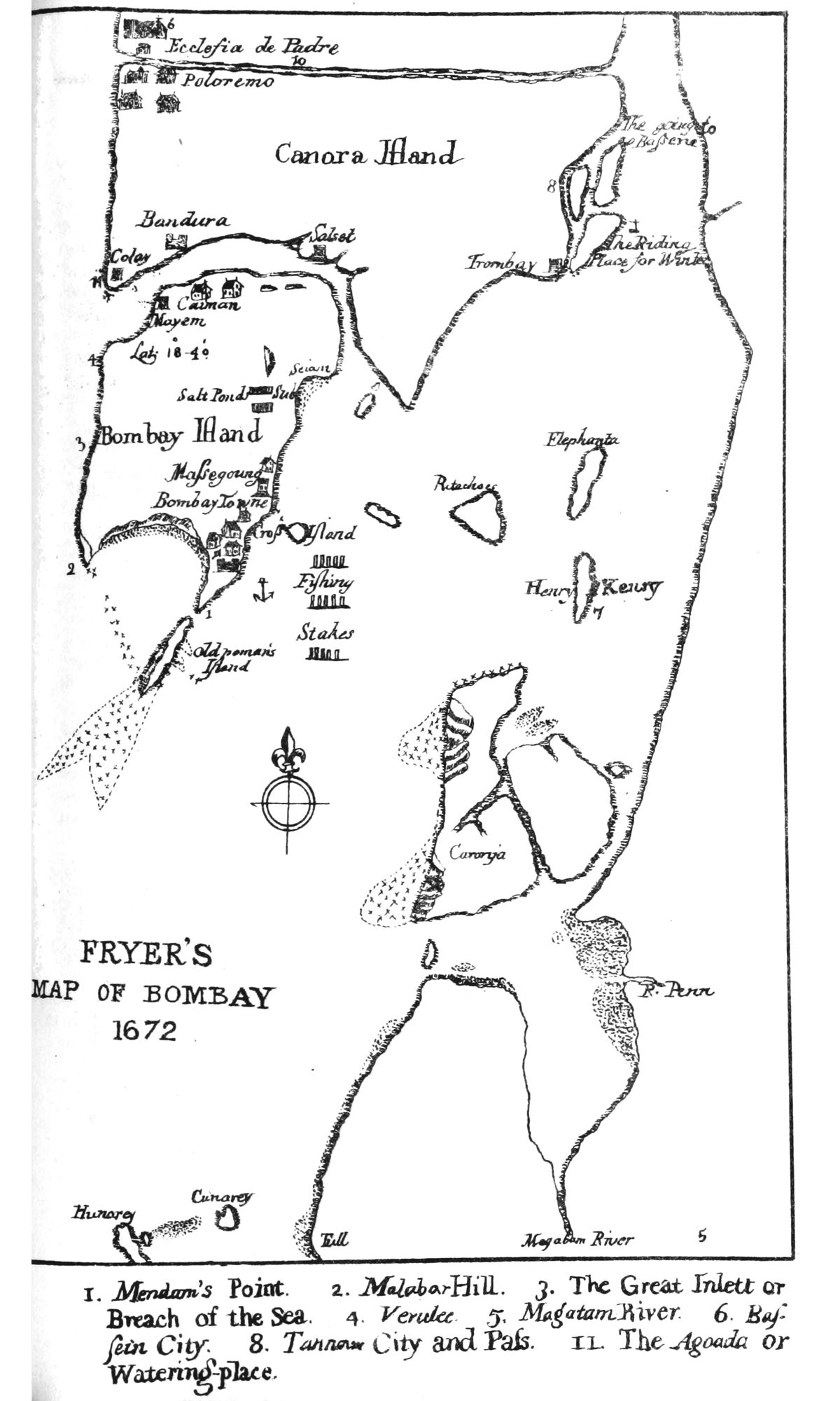
All the seven islands of Bombay and Colaba, a former Portuguese colony, since 1665 of British possession, began in 1672 a long process of land reclamation by building dikes between the narrow intra-island passages with the intention to produce additional area, initially for rice cultivation, agricultural and livestock purposes.
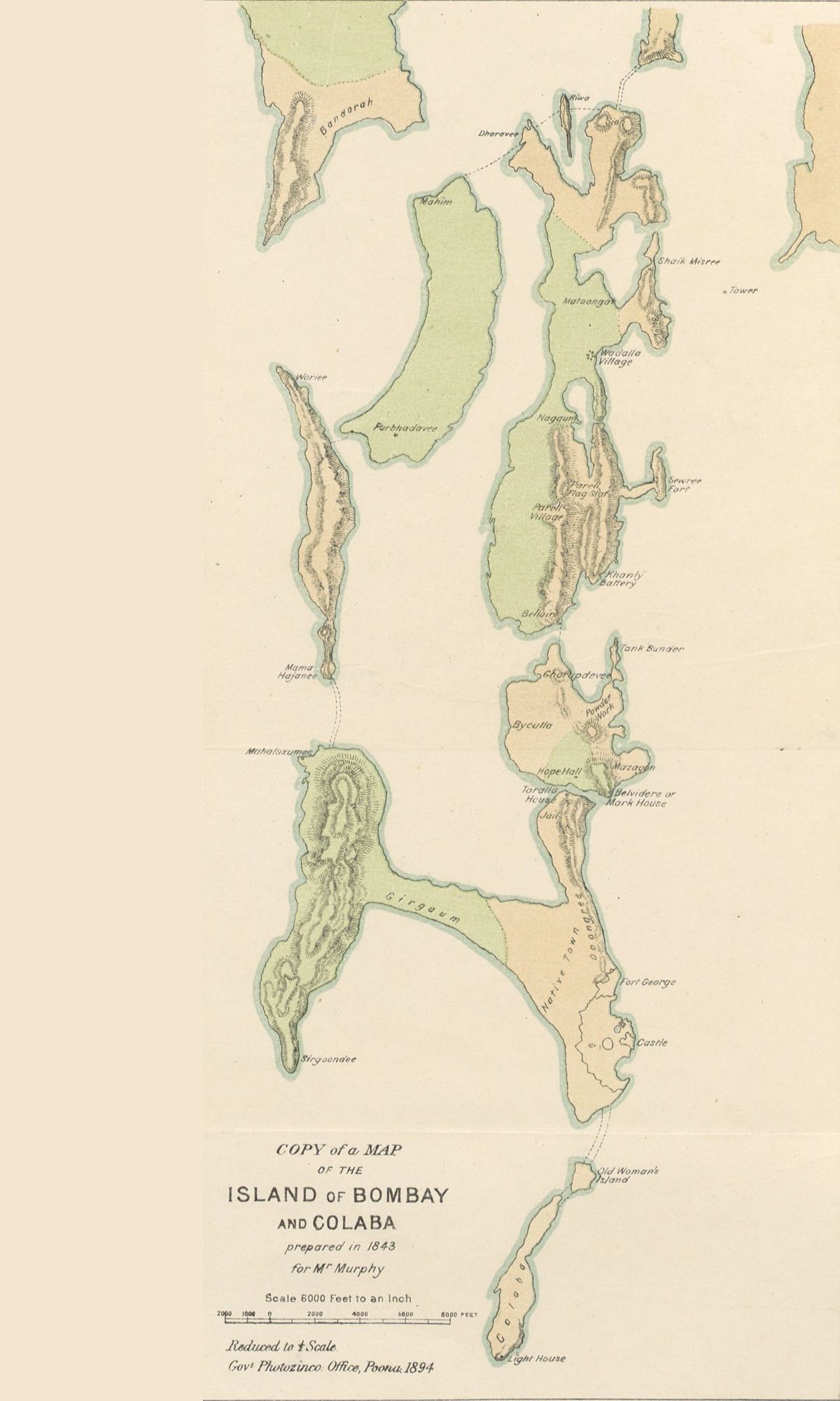
But it was not until 1860 with the construction of the Sion-Kurla Causeway, that the whole of islands became a peninsula, linked to mainland. At the beginning of the 1910s, as a result of the intense population growth in the region and the consolidation of the city as the economic capital of India, there was a strong demand for new developable land, which brought in the following decades the disappearance of agricultural land and a strong development of land reclamation.
Until 2020, 385.6 km2 of territory had been generated by land reclamation techniques in the area of the Mumbai peninsula, and the forecast for this century is to reach 1,000 km2, basically intervening in the area of Mumbai Bay, which means that there is still a missing of 600 km2 to be developed, giving opportunity to new technical interventions that offer solutions for medium depth and master plans that are capable of integrating sustainable growth.
This scenario represents a broad field of action for engineering and advanced consultants in this area, such as Landboxes.
Next steps
After a detailed study of current interventions, our team will focus on bathymetric and geological studies to gather information about of potential areas of intervention, specifically in the Mumbai Bay area.
During the next months these results will be presented moving on to the next phase where specific developments based on the Landboxes System will be proposed.
What are we looking for?
We would like to Industrial and institutional partners to join and take part of these exercises or at some level to integrate their solutions or proposals to our masterplan.
CONTACTMumbai Area and Bathymetry
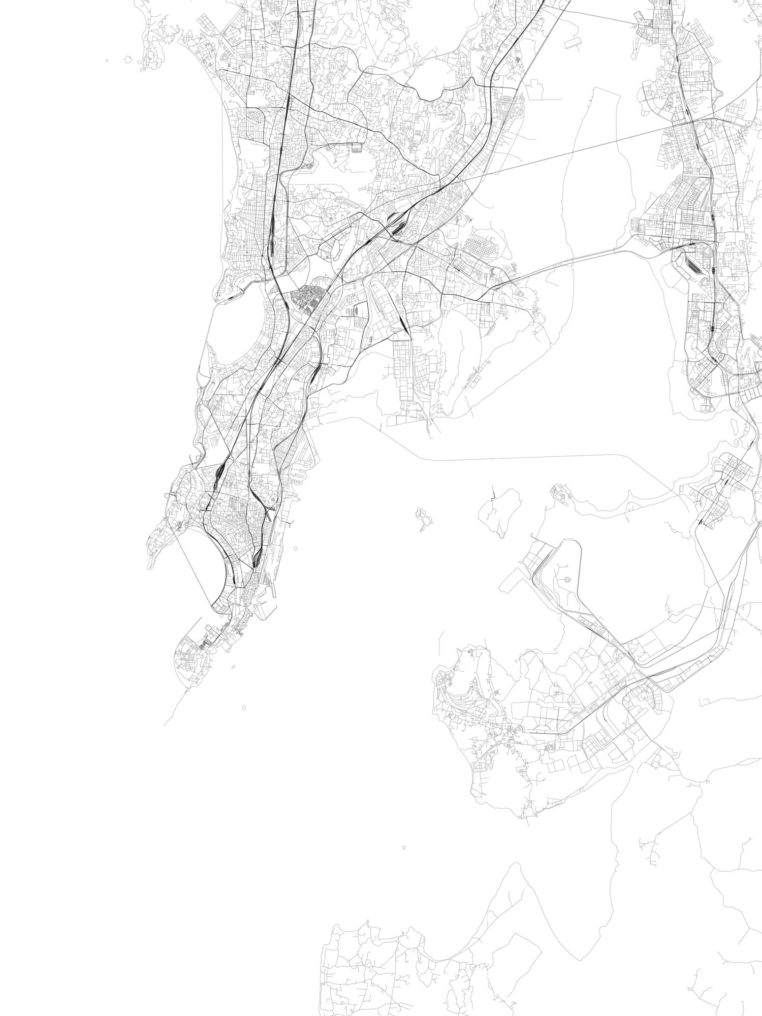
Mumbai. Urban Area
Image Design: Landboxes
Data Source: Open Street Map
Dataset: Road Hierarchies

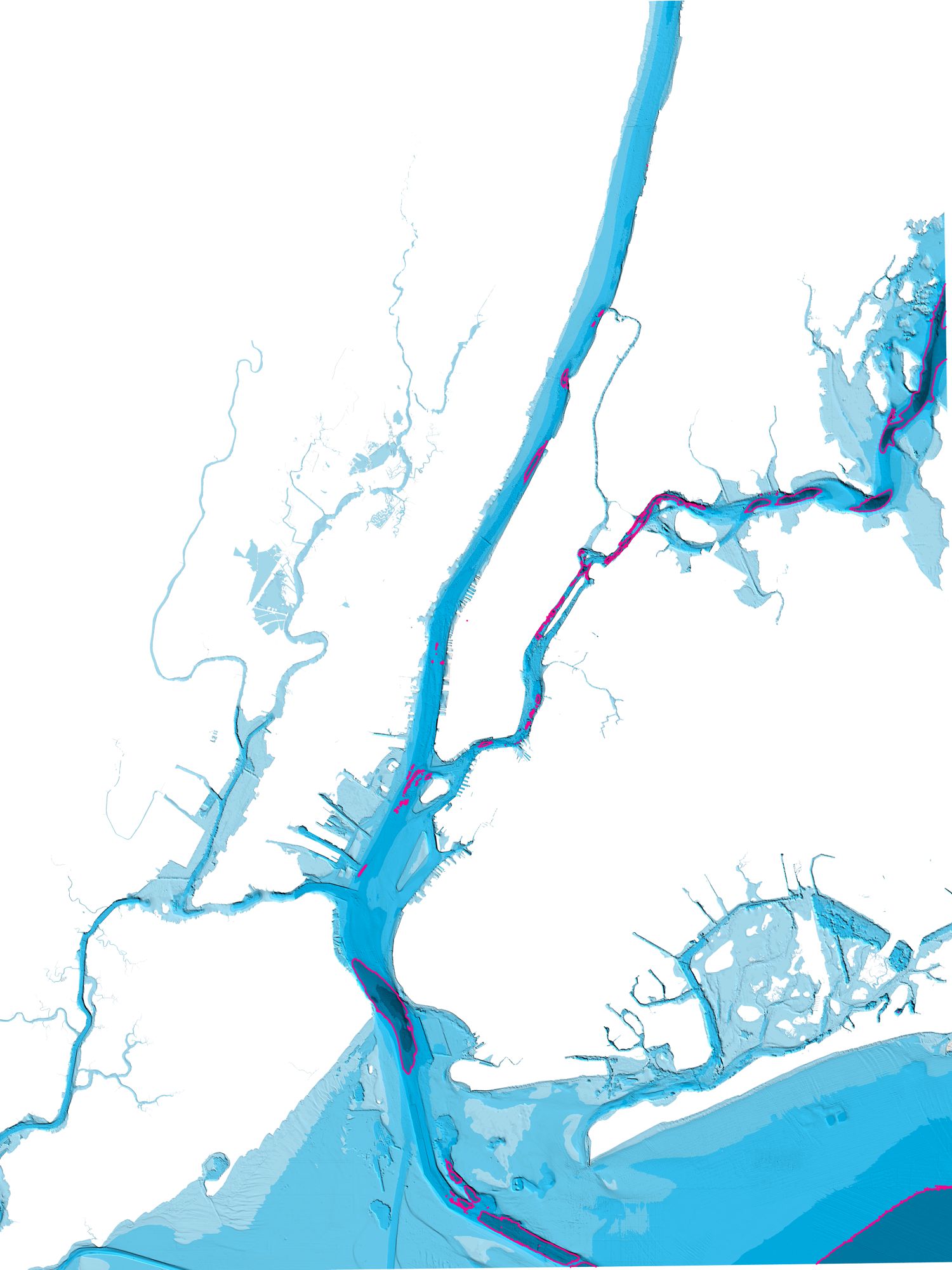
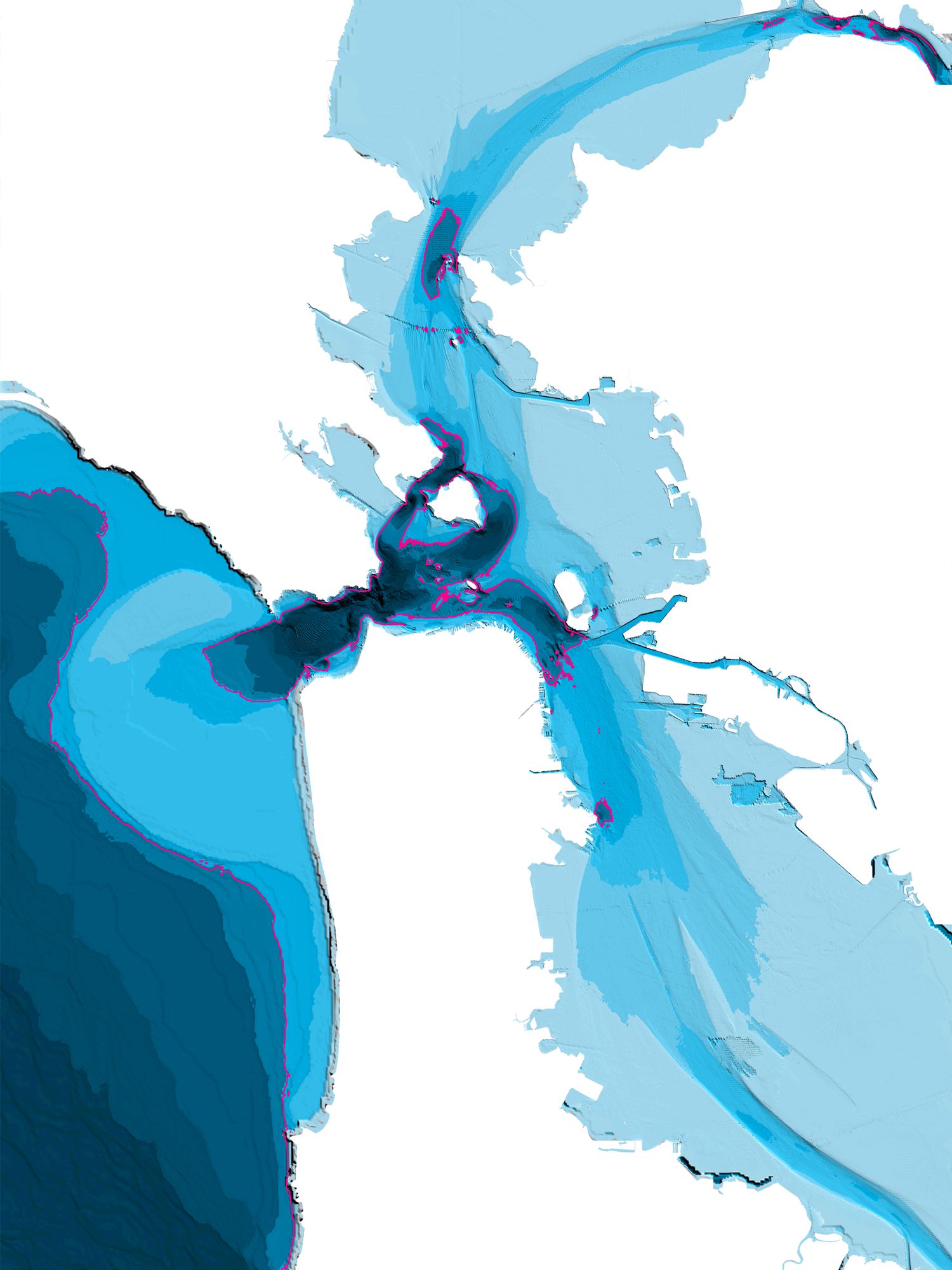
Mumbai. Bathymetry
Image Design: Landboxes
Data Source: NOAA’s National
Centers for Environmental
Information (NCEI)
Dataset: 1/9 Arc-Second Resolution
Bathymetric-Topographic Tiles

New York Expansion
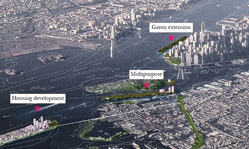
This is a digital land reclamation exercise from 2018 developed as a proof of concept based on Landboxes Units and different applications. The main new land generated is a large platform located under Governors Island, along Red Hook and following the lower Brooklyn coastline. This would be an area of great value because of its proximity to Lower Manhattan and the ease of connecting to communications networks.
Additionally, and through smaller groupings of Landboxes Unit, we make 3 more digital applications: an infrastructure support area on the East River, facing the Upper East Side and Queens riverside; a green support area on the Hudson River, beside the Financial District; and finally a multipurpose area between Governors Island and Brooklyn Bridge Park.
Historically, many land reclamation exercises have been raised on the Hudson and East Rivers, as well as the Upper New York Bay. They are very interesting areas given the shortage of high value land in the mega-cities of the 21st century.
Info: New York City
Current Population: 8,622,698
Current population in the Metropolitan Area: 20,300,000
Land area: 302.64 sq miles
Population density: 28,491 per sq mi
New York Intervention
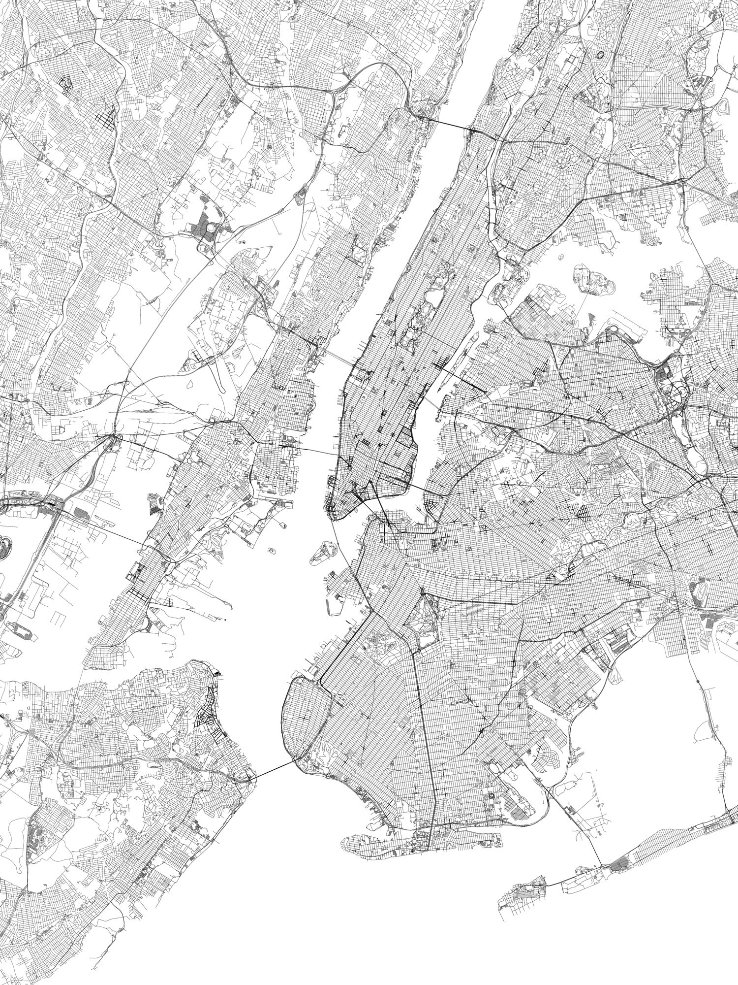
New York. Urban Area
Image Design: Landboxes
Data Source: Open Street Map
Dataset: Road Hierarchies
New York. Bathymetry
Image Design: Landboxes
Data Source: NOAA’s National
Centers for Environmental
Information (NCEI)
Dataset: 1/9 Arc-Second Resolution
Bathymetric-Topographic Tiles
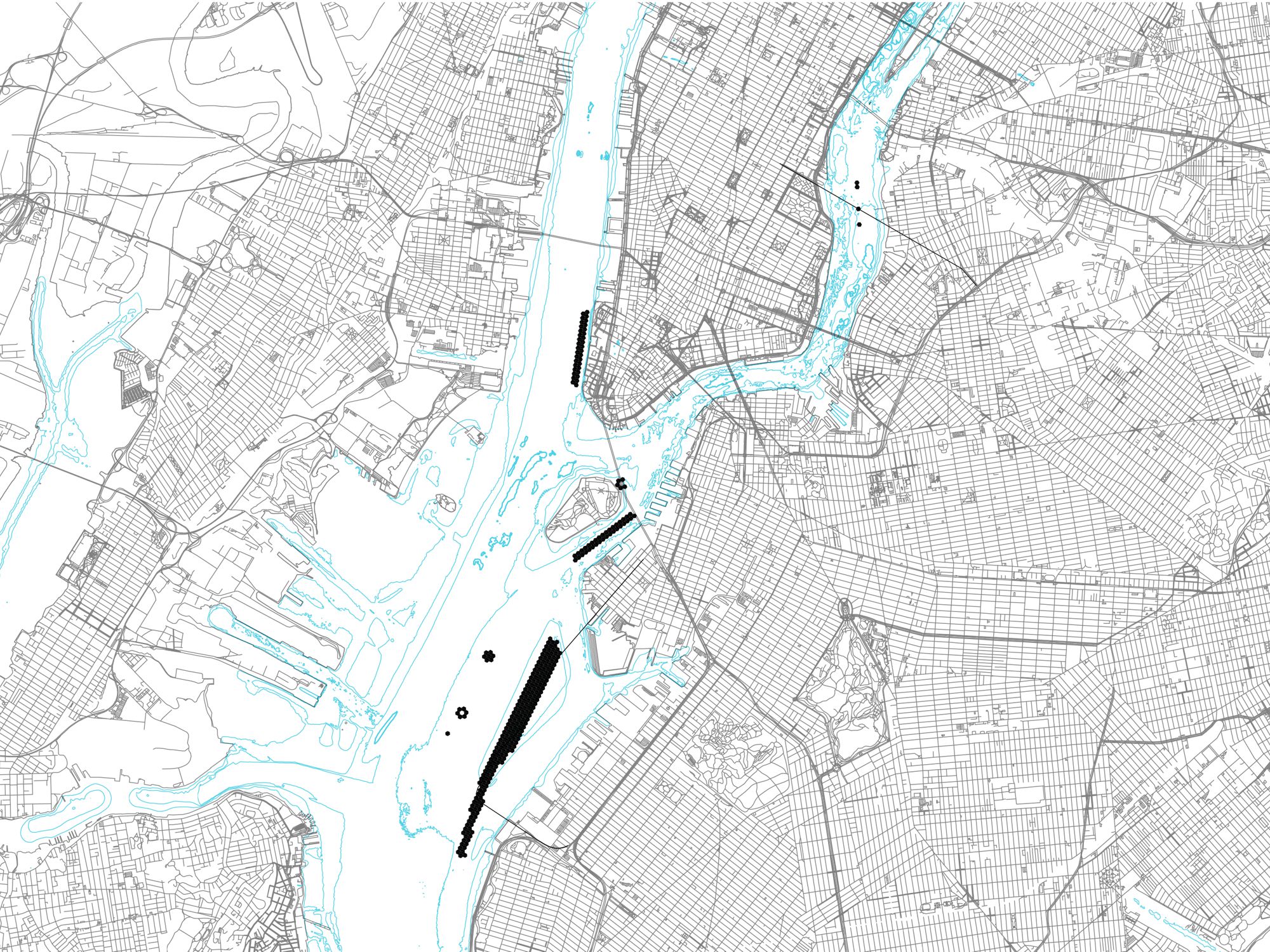
New York. Intervention Map
Image Design: Landboxes
Proposal: Research Exercise 2019
Team: LAIA Lab NY
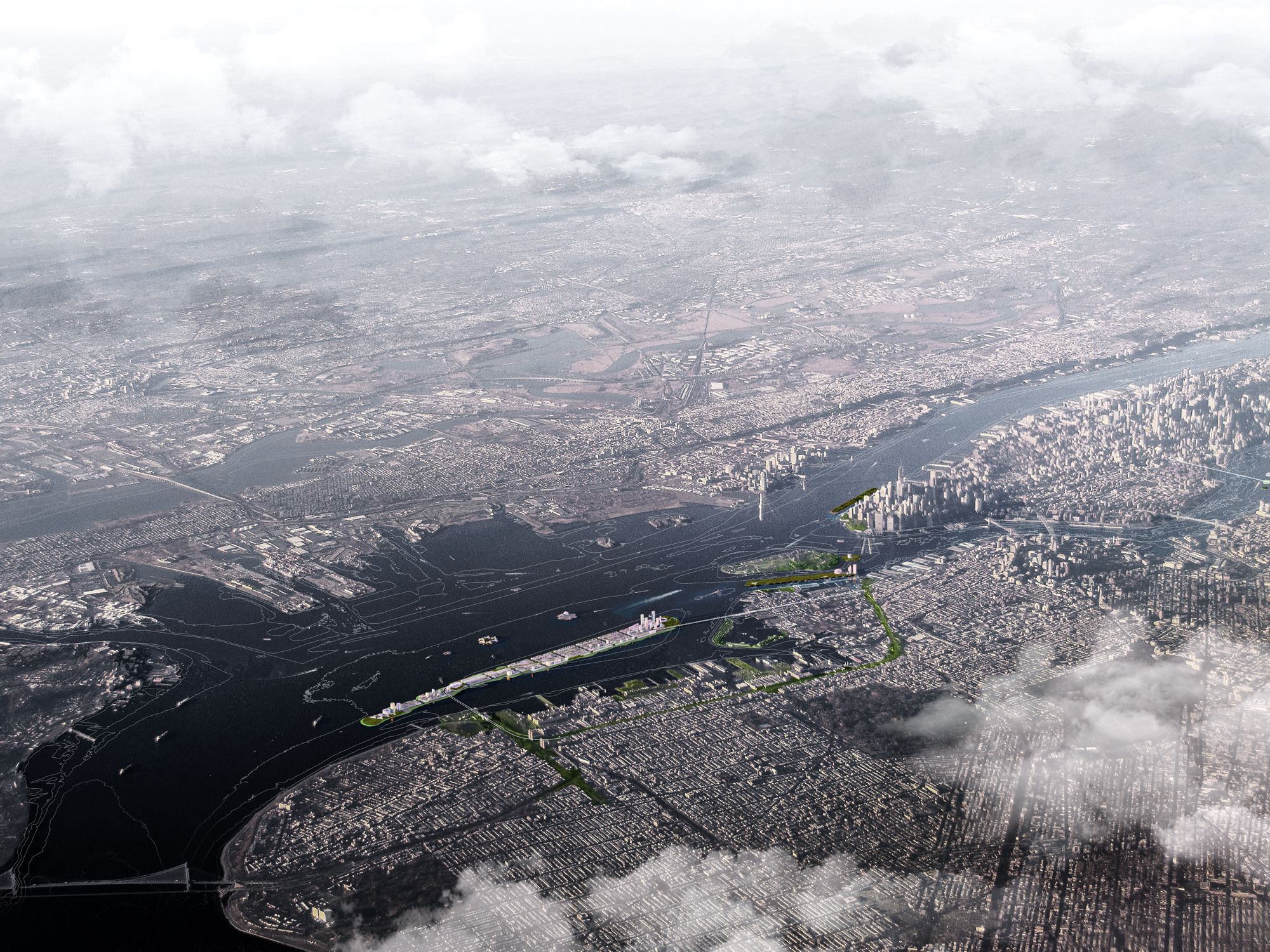
New York. Intervention Render
Render Design: Landboxes
Proposal: Research Exercise 2019
Team: LAIA Lab NY
San Francisco Expansion
This is a digital land reclamation exercise from 2018 developed as a proof of concept based on Landboxes Units and different applications. The main new land generated is a large platform located under Governors Island, along Red Hook and following the lower Brooklyn coastline. This would be an area of great value because of its proximity to Lower Manhattan and the ease of connecting to communications networks.
The work consisted of obtaining geographic, topographic, urban layout, and mining of sociodemographic data, to project bathymetries of the zone and reach conclusions about risk areas and others with growth or development possibilities.
In addition, different intervention formats were considered, such as the grouping of Landboxes Unit, in reduced formats, for use as infrastructure support elements; in medium-sized interventions, for multipurposes; and also a large platform as a possible extension of the existing urban layout, easily connected to the coastline infrastructures.
Info: San Francisco City
Current Population: 884,363
Current population in the Bay Area: 7,000,000
Land area (city): 46.89 sq miles
Population density: 18,860 per sq mi
San Francisco Intervention
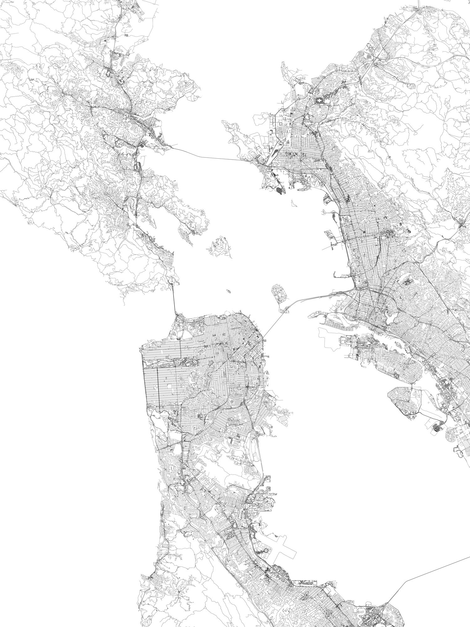
SF. Urban Area
Image Design: Landboxes Data Source: Open Street Map Dataset: Road Hierarchies
SF. Bathymetry
Image Design: Landboxes
Data Source: NOAA’s National
Centers for Environmental
Information (NCEI)
Dataset: 1/9 Arc-Second Resolution
Bathymetric-Topographic Tiles

San Francisco. Intervention Map
Image Design: Landboxes
Proposal: Research Exercise 2018
Team: LAIA Lab NY
Developing new lands
Some of the countries that have developed and are developing on new land are China (4600 square miles), Netherlands (2700 sq mi), South Korea (600 sq mi), Bahrain (122 sq mi), Japan (110 sq mi), Singapore (52 sq mi) and Bangladesh (42 sq mi). In the United States, land reclamation has happened and is happening in big hub cities such as San Francisco, Chicago, Boston and New York, among many others. To sum up, land reclamation is a phenomenon that will continue to happen, and at a mayor scale given the population growth expected during this century from 7 billion to 10 billion according to the World Population Prospects.
moreThe coast has always been a recursive environment to thrive various civilizations, building multiple cities across the world in direct relation to this wet landscape, serving as the layout for the development of following generations. Our ancestors sought the coast for its resource abundance –from food to transportation–, presenting good trading opportunities which promoted development in strategic coastal spots. This trend has not changed, and with an increasingly growing population mixed with the current built up area of cities, we are in need to challenge the standard ideas of our built environment along the shorelines. Some of the pressures that motivates us to make a change are the following:
-Urbanization: This process consists in the shift of a rural population towards an urban population. Nowadays, about 54% of the world population lives in urban areas, and this is expected to increase to 66% by 2050 according to the World Urbanization Prospects.
-Migrations: The inequality in relation to employment opportunities, especially between the north and south hemispheres, makes of the northern countries a very attractive destination to many migrants. Adding to this mix, in the southern hemisphere are found some of the fastest growing population worldwide. So, it seems that migrations will not stop any time soon, and we hope it does not.
-Tourism industry: Worldwide, at 2016 levels, we were experiencing a population of over 1.2 billion visitors per year. Cities like New York itself hosts about 60 million visitors a year.
-City Sprawl: Typically, a city grows radially, creating suburbs which are generally far from a city. In the case of a coastal city, this accentuates much more, growing further away from the urban center, which leads to a bad planning where private transportation is a must.
In this sense, birthrates can remain stagnant or even decrease; tourists, migrants, and the process of urbanization itself can continue to carry the population growth of a city. The points mentioned above, in relation to the urban fabric, have leaded towards a general quality loss in the urban planning, driven by the promptness in which these are done. Though speed is necessary, this can lead to issues such as social inequality, loss of pedestrian space, or the non-preservation of historic elements of a city. The process of city making is much more complex than laying a grid and parceling to build, and we need to grant planners the time to plan our cities for the future.
Cities in developed countries have now reached the point in which is very challenging to find a spot to stablish any industrial, commercial, agricultural or housing activities nearby a city´s center – where you get most of the value within the urban, but this is not new. Understanding that the lack of land for new developments is way more extended in coastal cities, for centuries we have created new land along our shorelines with an old technique currently denominated as ¨land reclamation¨ or “landfill”. This refers to projects that gain land to the sea, currently using dredging as the standard methodology to do so. Once new land is created, new development can be built on top.
While dredging has replaced draining in the process of land reclamation (see the Netherlands), landfilling itself has remained stagnant for centuries; the only improvements in the field of land reclamation is the technology to recollect and relocate sand, which typically means more powerful boats and general equipment needed to do so. What we are to propose here is, what we think of an improvement for land reclamation as a methodology. A system to create land that solves the issues of moving seabed’s sand from one location to another with its consequential environmental impact, a system capable of avoiding the displacement of coastal communities, one that accelerates considerably the construction speed of land reclamation projects, improves in security, improves in endurance, and provides a tremendous flexibility of where it is decided to be built.