Landboxes
System / Prototyping Foundations

Our team explores novel foundations on the seabed to optimize the performance, stability and viability of each Landboxes Unit, Application and Development.
Landboxes foundations intro
Landboxes explores novel foundations to optimize the performance of each unit for their usage. This will determine the location where each Landboxes Unit, Application or Development is placed, hence the seabed typology. The variation in the seabed can be understood by comparing the Mediterranean Sea with the Persian Gulf; while the Mediterranean Sea is steep near the coast and having an average depth of 1500 meters, the Persian Gulf is shallow and has an average depth of 50m. This has allowed the construction of artificial islands in the Persian Gulf with techniques such as dredging, whereas in the Mediterranean are few examples. Moreover, the composition of each seabed varies, changing the depth of where the rock layer is located, making it accessible or inaccessible in different cases.
Foundation Typologies
Given the different needs that each Landboxes Unit has, there is value in expanding the foundation typologies further than what is already in place brought by the offshore oil and the port construction industries. For this, the System proposes a workflow that stems from the geographical location of the Landboxes, aiming to provide the best solution for each use case (please see Workflow chapter). Geographic Information System (GIS) is used for to perform a geographical analysis of each location, gathering data such as LIDAR bathymetries, sea currents, climate, or level of salinity among others. As a first exercise, there are three foundation typologies that are explored for different use cases:
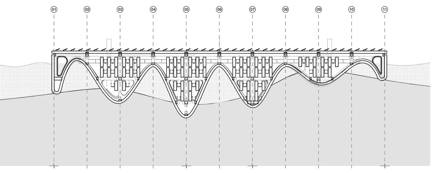
A) Floating Data Center
A data center is a use case for which the Landboxes Unit can be readapted given its needs for refrigeration. For it, the bottom shape of the Landboxes is redesigned as a sinusoidal shape for it to act as a heat sink to help in dissipating temperature from the heating interior (computers) towards the cooling exterior (water body). If this data center is needed to be located in deep waters, the load distribution is redesigned to lower the point of gravity, such as spar platforms. In this sense, after being moored on the seabed, this design can better stand the effects of wind, waves and currents.
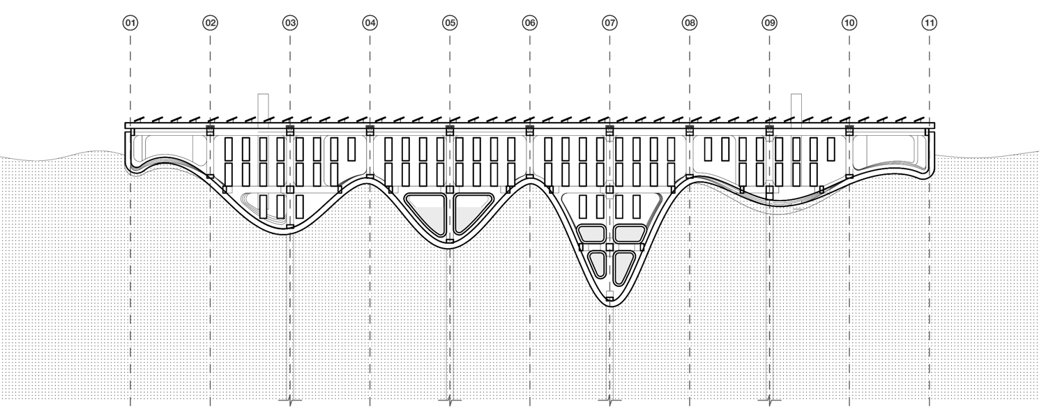
B) Grounded Data Center + erosion control
This same data center, if located near the shoreline where there is no need for floatation, can be redesigned to adapt to the specific seabed while taking advantage of the heat dissipating sinusoidal shape proposed. In this sense, the heat will be dissipated through its contact to both, water and ground bodies. Simultaneously, since it is a moored system, the sinusoidal shape accumulates eroded sand wandering around the sea. This shape can be tuned to achieve a desired level of erosion control, contributing to the modification or maintenance of the boundaries of our shorelines. Loads are distributed to the sides to achieve a better stability on the ground.
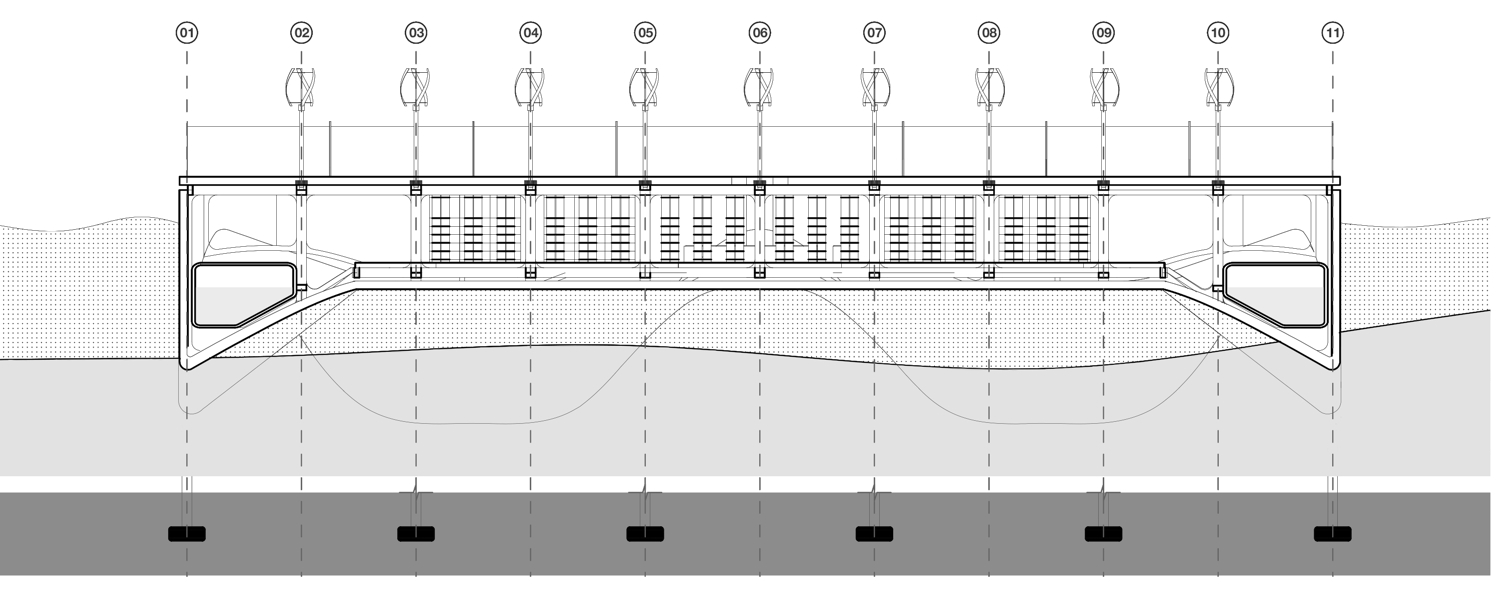
C) Grounded Warehouse
Centralizing storage in offshore dedicated facilities is a way to release pressure from valuable mainland, hence a use case of the Landboxes that has to be adapted to both; to the waterfront of a city, and to the specific condition of that specific seabed. In regard to the waterfront, the side that is connected to it must have the same inclination and height to distribute the stored material. In regards of the seabed, this Landboxes Application allows space beneath it for the water to pass through. In this sense, as well as the previous case, the Landboxes Unit can contribute to manage the natural cycles of the sea.
The need for each unit will determine the location of each Landboxes Unit, hence a fast analysis, prototyping, and evaluation process is necessary to adapt to each use case.